We woke to gorgeous blue skies and calm waters so pulled the anchor after lunch for the 20 odd nm to Gove Harbour.
Thursday, February 4, 2016
post Gulf
We slept and tidied Manatee after our Gulf crossing, giving ourselves 24hrs before heading up to Gove and then around to Darwin.
We woke to gorgeous blue skies and calm waters so pulled the anchor after lunch for the 20 odd nm to Gove Harbour.
Gulf crossing - only look ahead!
The weather forecast for our crossing was variable 10-15kts increasing to 20kts NE/SE! We were happy with this as the winds and seas were forecast to increase at the start of the next week.
We were eager to visit Groote Eylandt after deciding not to sail down the western side of the
Cape due to the smoke. Our planned track was a distance of 322nm and we were hoping for kind seas. The Gulf is shallow and the seas can be huge! We had heard horror stories but we took comfort in the fact that Manatee loves a good surf.
No morning glory but a fabulous swell so Manatee had a surf, but it was tiring hand steering so as not to broach. I only look behind once and gave myself a fright at the size of the swell!
We managed 70nm overnight and decided to head to Cape Arnhem rather than spend another night at sea as we were both very weary. In the early hours of the morning a large fishing vessel came very close to Manatee giving Marg a scare.
At 1540 we had 21nm remaining, at 2100 we had the anchor down off Cape Arnhem's beach. Hooray we did it in 57 hours.
We were eager to visit Groote Eylandt after deciding not to sail down the western side of the
Cape due to the smoke. Our planned track was a distance of 322nm and we were hoping for kind seas. The Gulf is shallow and the seas can be huge! We had heard horror stories but we took comfort in the fact that Manatee loves a good surf.
![]() |
Groote Eylandt-the large island on the NT side of the Gulf We set the alarm for 0400 to be ready to use the tide to exit Weipa. The channel was extremely busy with shipping movements so we waited for a break in traffic before contacting Weipa VTS for clearance at 0545. We were told to wait for another departing ship and to follow her out-damn. We pulled the anchor at 0600 and had the main up at 0615 ready to follow and left Weipa with an incoming tide, managing only 4kts. Shoulda got up earlier! We did spot a whale at 0800 which improved our spirits. The seas were choppy and confused overnight which was very tiring- we had an overnight watch system of 4 hours and a daylight watch of 6 hours. Our first 24hrs gave us a distance of 105nm and I woke to beautiful seas like frosted glass. That afternoon we changed our heading for Gove as we encountered a nasty beam swell. We saw no other boats or any coast guard aircraft. At 1415 we had only travelled around 34nm. With our new waypoint of Gove we had 146nm remaining at 1730. I was eager to see a cloud named the morning glory which is a rare meteorological phenomenon found in the Gulf. |

No morning glory but a fabulous swell so Manatee had a surf, but it was tiring hand steering so as not to broach. I only look behind once and gave myself a fright at the size of the swell!
We managed 70nm overnight and decided to head to Cape Arnhem rather than spend another night at sea as we were both very weary. In the early hours of the morning a large fishing vessel came very close to Manatee giving Marg a scare.
At 1540 we had 21nm remaining, at 2100 we had the anchor down off Cape Arnhem's beach. Hooray we did it in 57 hours.
Weipa.....what can I say!
The next morning we rested while we waited for the seas to calm. At 1430 we pulled the anchor for the trip to Weipa, following the marked channel to Evans Landing. We anchored in the little bay, making sure we were well clear of the wharf with huge cargo ships that take bauxite to China.
We spent 3 days walking around Weipa, which had a small industrial area and a huge 'workers camp'-uninspiring dongas. Buses picked up and dropped off workers in high-vis uniforms regularly.
We visited the 'cultural centre' which is funded by the mine (Rio Tinto). It was very run down and the caretaker/administrator was a English woman who referred to the local Aboriginals as 'too lazy' to be involved in the centre. The exhibitions were, in my opinion, quite amateurish and neglected, with the pictorial exhibit showing the process of local mining presenting the end process of bauxite refining as steel. Oh dear!
The area between the Pennefather River and Cape Keerweer has a unique place in Australian history as the location of the first recognised contact between Aboriginals and Europeans. In 1606 the Dutch yacht Duyfken visited, in 1623 the Pera called both crews disappointed that there was no interest in spices!
We spent 3 days walking around Weipa, which had a small industrial area and a huge 'workers camp'-uninspiring dongas. Buses picked up and dropped off workers in high-vis uniforms regularly.
We visited the 'cultural centre' which is funded by the mine (Rio Tinto). It was very run down and the caretaker/administrator was a English woman who referred to the local Aboriginals as 'too lazy' to be involved in the centre. The exhibitions were, in my opinion, quite amateurish and neglected, with the pictorial exhibit showing the process of local mining presenting the end process of bauxite refining as steel. Oh dear!
'cultural' centre |
The area between the Pennefather River and Cape Keerweer has a unique place in Australian history as the location of the first recognised contact between Aboriginals and Europeans. In 1606 the Dutch yacht Duyfken visited, in 1623 the Pera called both crews disappointed that there was no interest in spices!
Friday, January 1, 2016
Same,same but different
On September 7th we raised the anchor at 0830, set the main and worked the tide to Crab Island. The forecast was 10-15kts SE. We passed throngs of turtles, schools of mackerel pointed out to us by flocks of seabirds and a dugong. The Crab Island anchorage was horrible-choppy, rolly and plain nasty! Plan B was Crystal Creek 2, we had a fisherpersons waypoints for entry into the creek, but clearly the sandbars has shifted so we anchored with 1m (LWT) under our keel at 1345. We amused ourselves during the night by shining torches on the schools of prawns that made Manatee their temporary home.
We awoke to Manatee's keel hitting the sand, so we pulled her in by the anchor windlass and then nudged her into deeper water by the dinghy. We seemed to amuse the dolphin pod that stopped by. Stupid humans. Once we has passed low tide we dinghied across to the beach for a walk to check out a wreck and to allow Ruby a good run.
We pulled the anchor at 1100 with the forecast 10-15kts SE for Vrilya Point and set down in 3m with enough time to have sundowners on the beach and entertain ourselves by beachcombing. Marvellous!
Prior to leaving Seisa we researched tides in the Gulf of Carpentaria and various viewpoints arose. No one including fisherpeople could give a definite answer. The most common view was that it flooded south, which it did for short amounts, during the flooding tide. The tide most certainly flowed westward from the Jackson River during the flood tide as we had difficulty moving south.
We reached the natural harbour entrance at 1000 and motored west following the shoreline before anchoring off the southern shore at 1230.
We headed around the point, tired after a long day of sailing, seeking shelter from the wind and somewhere upwind of the smoke. Pine River was too shallow to enter and we were getting desperate as the day faded. We were only managing 4kts in very choppy seas. We finally dropped the anchor at 2100 at the entrance to the Mission River.
leaving Seisia |
We pulled the anchor at 1100 with the forecast 10-15kts SE for Vrilya Point and set down in 3m with enough time to have sundowners on the beach and entertain ourselves by beachcombing. Marvellous!
Prior to leaving Seisa we researched tides in the Gulf of Carpentaria and various viewpoints arose. No one including fisherpeople could give a definite answer. The most common view was that it flooded south, which it did for short amounts, during the flooding tide. The tide most certainly flowed westward from the Jackson River during the flood tide as we had difficulty moving south.
We reached the natural harbour entrance at 1000 and motored west following the shoreline before anchoring off the southern shore at 1230.
We headed around the point, tired after a long day of sailing, seeking shelter from the wind and somewhere upwind of the smoke. Pine River was too shallow to enter and we were getting desperate as the day faded. We were only managing 4kts in very choppy seas. We finally dropped the anchor at 2100 at the entrance to the Mission River.
Saturday, December 5, 2015
Silent Seisia
Early in September we said adieu to the beauty of the islands and caught the tide out of the Ellis Channel. The forecast was SE 10-15kts rising to 20kts west of Cape York. We had a choppy exit escorted by a dolphin. We were moving at around 7kts until we turned to starboard, when our speed washed away until we were averaging 2kts. After our early start, Marg went below for a quick nap and suggested on her return that I had put the anchor down as we appeared to be in the same position! At least it was picturesque.
Seisia and the town of Bamaga (around 10km inland) are both Torres Strait Islander communities. Some of the original inhabitants, the Injinoo Aboriginal people, remain. Islanders from Saibai, which is one of the islands close to PNG, came across to the mainland when Saibai, which was swampy, was almost entirely underwater with a king tide in the late 1940's. Seisia (which was a name put together by the first letters of the names of the first settlers - Sagaukaz, Elu, Isua, Sunai, Ibuai and Aken) was called Red Island Point by the Injinoo. There are about 200 inhabitants. It is very laid back and the jetty is the hub of the community. On Sundays everyone goes to church, and the gospel singing caries across the water.
It is the most northern community in Australia and had the greatest sunsets.
On day 2 we took the dinghy to the jetty as it seemed the place to be! We unfortunately met up with a Quarantine Officer who requested our 'papers'. Even though we checked with the young officer at Thursday Island many times that we had all we needed, it seemed Ruby was entitled to return to the mainland, buy Marg and I weren't. A squabble between offices ensued, with us caught in the middle. The mainland officer realised that as Ruby had papers we obviously would have cleared quarantine as well. After considering fining us he decided that slagging off the TI officers was the best course of action. He requested that we tie Manatee up at the jetty the next day so he could inspect. We dutifully did that and he didn't turn up! We were finally given an apology and I suspect our papers were found behind the fax machine! It was very frustrating and upsetting and we tried to not let the incident colour our opinion of the islanders. A lot of yachties won't go to the islands, not only because of the tricky sailing but because the quarantine aspect is so unclear. It is worth it.
We spent many days exploring Seisia, visiting the Friday night markets (4 stalls), talking with the locals, sitting on the jetty and walking the amazing beaches.
We hitched into Bamaga to do some provisioning ( a charming ute full of Injinoo lads stopping to check that we were OK and apologising that they had no room for us),and to have lunch at the only pub, which had frozen packaged fish! We played lots of very bad pool. We met up with a fisherman who knew us from Port Douglas, who fished for mackerel in the Gulf and couldn't get the pub to stock fresh fish - go figure.
There was a petrol station in Seisia where you could purchase diesel and jerry - can it to boats, which is a bit beyond us these days when we require hundreds of litres. Our fisher mate advised that we could re-fuel via a barge in the channel but he recommended against it as it's a bit scary due to the chop. I spent hours on the phone to businesses in Weipa attempting to source diesel facilities for yachts and at one point we considered returning to Horn Island!. I finally got a lead where we might get fuel, booked via Cairns of all places, so we set off to the Gulf of Carpentaria.
Papou Point on the SE of TI We arrived in Seisia at 1200 and anchored behind the sandbank off Red Island, across the sandbar from the crowded 'harbour'. A beautiful spot. |
main street of Seisia |
It is the most northern community in Australia and had the greatest sunsets.
On day 2 we took the dinghy to the jetty as it seemed the place to be! We unfortunately met up with a Quarantine Officer who requested our 'papers'. Even though we checked with the young officer at Thursday Island many times that we had all we needed, it seemed Ruby was entitled to return to the mainland, buy Marg and I weren't. A squabble between offices ensued, with us caught in the middle. The mainland officer realised that as Ruby had papers we obviously would have cleared quarantine as well. After considering fining us he decided that slagging off the TI officers was the best course of action. He requested that we tie Manatee up at the jetty the next day so he could inspect. We dutifully did that and he didn't turn up! We were finally given an apology and I suspect our papers were found behind the fax machine! It was very frustrating and upsetting and we tried to not let the incident colour our opinion of the islanders. A lot of yachties won't go to the islands, not only because of the tricky sailing but because the quarantine aspect is so unclear. It is worth it.
We spent many days exploring Seisia, visiting the Friday night markets (4 stalls), talking with the locals, sitting on the jetty and walking the amazing beaches.
jetty in the distance
We hitched into Bamaga to do some provisioning ( a charming ute full of Injinoo lads stopping to check that we were OK and apologising that they had no room for us),and to have lunch at the only pub, which had frozen packaged fish! We played lots of very bad pool. We met up with a fisherman who knew us from Port Douglas, who fished for mackerel in the Gulf and couldn't get the pub to stock fresh fish - go figure.
There was a petrol station in Seisia where you could purchase diesel and jerry - can it to boats, which is a bit beyond us these days when we require hundreds of litres. Our fisher mate advised that we could re-fuel via a barge in the channel but he recommended against it as it's a bit scary due to the chop. I spent hours on the phone to businesses in Weipa attempting to source diesel facilities for yachts and at one point we considered returning to Horn Island!. I finally got a lead where we might get fuel, booked via Cairns of all places, so we set off to the Gulf of Carpentaria.
Thursday, December 3, 2015
Tuesday, Wednesday, Thursday and Friday Islands
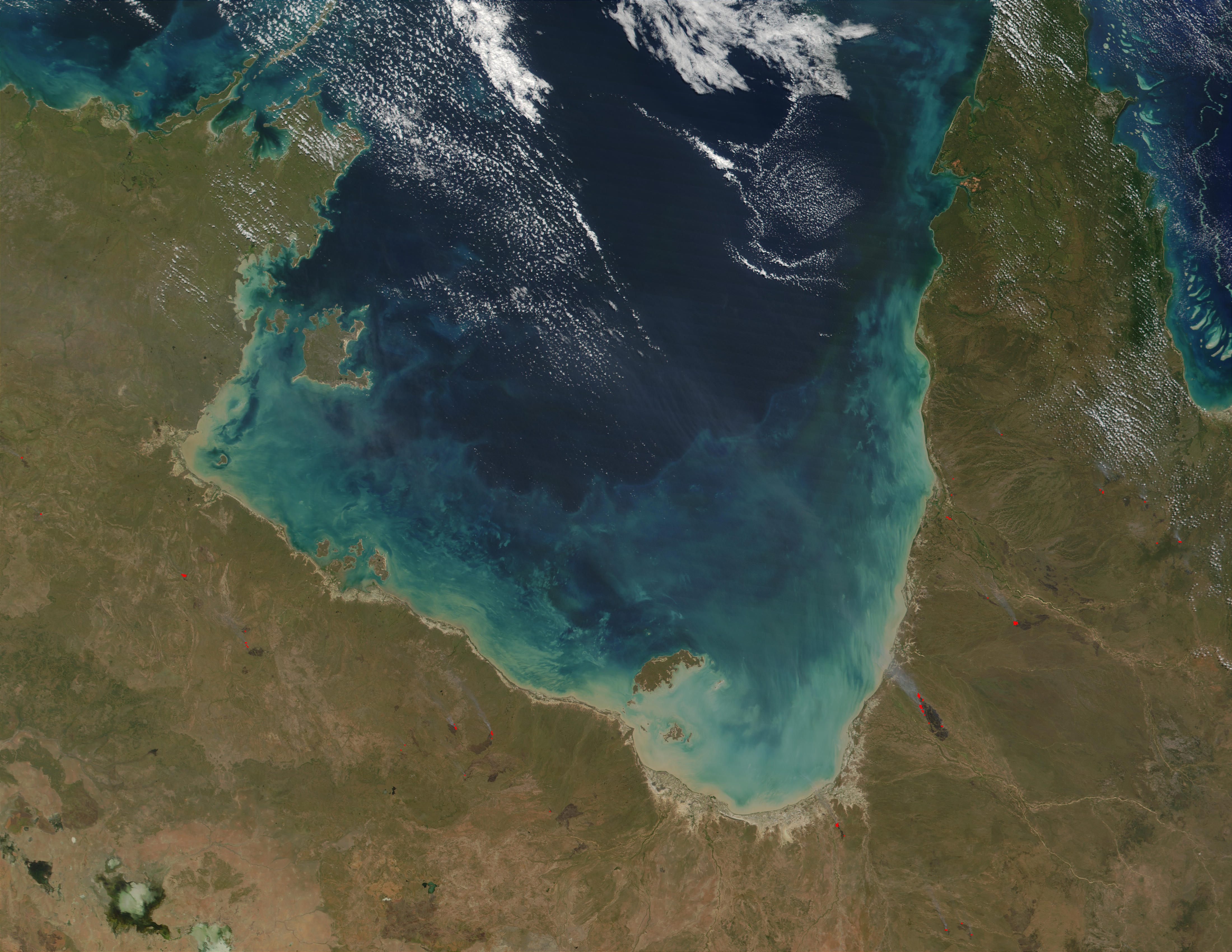
On the 27th August at 0930 we bid farewell to the Cape and pulled the anchor for Thursday Island (Waiben). The seas were extremely choppy. We tacked numerous times in an attempt to keep the swell on our stern rather than our beam. Welcome to the Torres Strait- windy, choppy, extreme currents! Anchor down Horn Island 1330.
The strait has a scattering of islands, including Tuesday, Wednesday, Thursday and Friday, which run like stepping stones from Cape York to Papua New Guinea.
Thursday Island (Waiben) is the commercial and administrative hub for 20 communities spread across 100 islands. Prior to European arrival in the straits, Thursday Island was un-inhabited, possibly because its island name Waiben means place of no water. Even though many communities have very close ties and are only a few km from PNG (with islanders roaring across in their tinnies to obtain cheap fuel amongst other things), islanders are Queenslanders. Due to fears of PNG pests and diseases reaching the mainland, the area is considered a 'special quarantine zone', which caused us much angst re: Ruby. It was very difficult to obtain specific advice. Whether that was due to quarantine officers not understanding regulations/laws or the basic laid back attitude of islanders, I will never know.
A little history - in 1606 the renowned Portugese navigator, Luis Vas de Torres sailed through the strait which was given his name. After the establishment of the penal colony at Sydney Cove, the Torres Strait became the main thoroughfare to and from England. Immigrants from Asia, the South Pacific and Europe moved to Thursday Island to work in the pearling industry in later years. The Japanese were the most numerous of the new immigrants and played a significant role in every aspect of the pearling industry, including diving, captaining vessels and construction and maintenance of pearl luggers. Thursday Island had its own ‘Japanese town’, with boarding houses, stores, a divers club and a public bath house. During the war, Thursday Island became a centre for military operations in the Torres Strait with war artefacts playing a large part in the tourism industry. Horn Island had a museum that covered a bit of all aspects of the areas history.
Tuesday or Wednesday? |
The strait has a scattering of islands, including Tuesday, Wednesday, Thursday and Friday, which run like stepping stones from Cape York to Papua New Guinea.
Thursday Island (Waiben) is the commercial and administrative hub for 20 communities spread across 100 islands. Prior to European arrival in the straits, Thursday Island was un-inhabited, possibly because its island name Waiben means place of no water. Even though many communities have very close ties and are only a few km from PNG (with islanders roaring across in their tinnies to obtain cheap fuel amongst other things), islanders are Queenslanders. Due to fears of PNG pests and diseases reaching the mainland, the area is considered a 'special quarantine zone', which caused us much angst re: Ruby. It was very difficult to obtain specific advice. Whether that was due to quarantine officers not understanding regulations/laws or the basic laid back attitude of islanders, I will never know.
A little history - in 1606 the renowned Portugese navigator, Luis Vas de Torres sailed through the strait which was given his name. After the establishment of the penal colony at Sydney Cove, the Torres Strait became the main thoroughfare to and from England. Immigrants from Asia, the South Pacific and Europe moved to Thursday Island to work in the pearling industry in later years. The Japanese were the most numerous of the new immigrants and played a significant role in every aspect of the pearling industry, including diving, captaining vessels and construction and maintenance of pearl luggers. Thursday Island had its own ‘Japanese town’, with boarding houses, stores, a divers club and a public bath house. During the war, Thursday Island became a centre for military operations in the Torres Strait with war artefacts playing a large part in the tourism industry. Horn Island had a museum that covered a bit of all aspects of the areas history.
Many of the islanders were very friendly and very Christian, even a taxi driver offered us a bible. We were 'god blessed' many times. The water colour was an amazing jade, filled with lots of bities. Fishing by locals was a constant, jetties covered by families putting a line in at dusk and tinnies constantly buzzing around.
looking across to Horn Island from Waiben |
view from Horn Island jetty |
We anchored off Horn Island rather than Weiben as the holding was better. Even there it took us a few attempts to get our anchor to set due to the fast currents. We braved the channel to visit Waiben a few times in our tender but decided the inter island ferry was a safer bet. A very strong wind would rise out of nothing and we all got drenched by high seas in one very scary trip. We enjoyed walking around Waiben and we also spent a lot of time in the quarantine office getting clearances.
street scene Waiben |
Waiben PO Our visit was following the visit by then PM Abbott. Not a good word was said about him by the islanders. He managed to antagonise everyone! Well done Tony. The local paper was filled with letters and editorial bagging him. A local hotel owner was furious as Abbott's staff had booked every room and then cancelled at the last minute, losing the hotel substantial income. Abbott allegedly was staying in a tent "in a room" at the army barracks instead. The local paper was denied a press pass with cries of 'it's just a publicity stunt' being pretty close to the truth, I thinks. When the journalist from the local managed to turn up at events, Abbot's staff allegedly demanded to know how they were informed of the schedule. Well hello, its a small community and everyone was really pissed off. The only good word was that he spent 'a bit of money' at the art gallery. The Gab Titui Cultural Centre was fabulous. We were lucky enough to view an exhibition on masks- exciting and scary. Here is their link- http://www.gabtitui.com.au/. And yes the gallery shop was fantastic. A large portion of art was centred on ghost net art - making art works from the discarded fishing nets which wash up on our shores or continue catching marine life indefinitely. Here's a great video- |
Our beloved Ruby was going through a bad patch, appearing very lethargic and off-colour. Luckily she didn't require a vet check to return to the mainland, rather an inspection by a quarantine officer. The young chap who attempted to poke her got a scary snarl in response so we were grateful when an older man with his own Jack Russell took over and gave Ruby clearance. The youngun did the paperwork for both Ruby and ourselves and managed to stuff it up- but more on that later! Ruby did enjoy the ferry trip.
almost smiling! |
We did have a moment when we considered staying in the straits for an extended period as the hospital was employing EENs. Alas the trade winds are the strongest and longer lasting than anywhere in the world. Combined with reefs and fickle currents, the straits are a very difficult area to sail through. We set off looking for a more secure anchorage.
Cape York
On the 23rd August we pulled the pick at 1130 in Shallow Bay for our much anticipated sail around the tip. How exciting!
Eborac and York Islands stand just north of Cape York, the extreme northern tip of main land Australia. With local knowledge, the pass between the islands and the mainland can be traversed, but it looked really dicey.
We were both emotional as it felt like another important milestone. Even though we thought we would be exploring other countries by this time, we are thoroughly enjoying our investigation of Australia, and wouldn't change anything.
We dropped anchor at 1330 and cracked a bottle of champagne. Words cannot describe the area so I'll let pictures tell some of the story.......
We spent many days feeling very lucky. The beachcombing was varied-unfortunately lots of nets, thongs and plastic. Marg was looking for a right thong, surprisingly 95% of thongs were lefties. The beach walks were fantastic. We watched many schools of tuna with attendant sea birds. We walked to the marker cairn and Ruby got lots of tourist pats.
Bus loads of tourists would arrive by day, have a quick walk to the tip, have their photo taken and then return to their bus. Quite a few were elderly with walking aids and they did fabulously well to make the walk, which has some rock hopping. By night, we had the area to ourselves and we were the only boat in the anchorage. Magic does happen!
The Wilderness Lodge which is a few minutes walk from the beach and was featured regularly on travel shows has unfortunately closed down. A very sad sight. A great opportunity for someone when tourism increases in the area.
Happy days!
Eborac Island- at the tip |
Eborac and York Islands stand just north of Cape York, the extreme northern tip of main land Australia. With local knowledge, the pass between the islands and the mainland can be traversed, but it looked really dicey.
We were both emotional as it felt like another important milestone. Even though we thought we would be exploring other countries by this time, we are thoroughly enjoying our investigation of Australia, and wouldn't change anything.
We dropped anchor at 1330 and cracked a bottle of champagne. Words cannot describe the area so I'll let pictures tell some of the story.......
We spent many days feeling very lucky. The beachcombing was varied-unfortunately lots of nets, thongs and plastic. Marg was looking for a right thong, surprisingly 95% of thongs were lefties. The beach walks were fantastic. We watched many schools of tuna with attendant sea birds. We walked to the marker cairn and Ruby got lots of tourist pats.
Bus loads of tourists would arrive by day, have a quick walk to the tip, have their photo taken and then return to their bus. Quite a few were elderly with walking aids and they did fabulously well to make the walk, which has some rock hopping. By night, we had the area to ourselves and we were the only boat in the anchorage. Magic does happen!
The Wilderness Lodge which is a few minutes walk from the beach and was featured regularly on travel shows has unfortunately closed down. A very sad sight. A great opportunity for someone when tourism increases in the area.
Happy days!
Subscribe to:
Posts (Atom)